
Show buyers the whole property
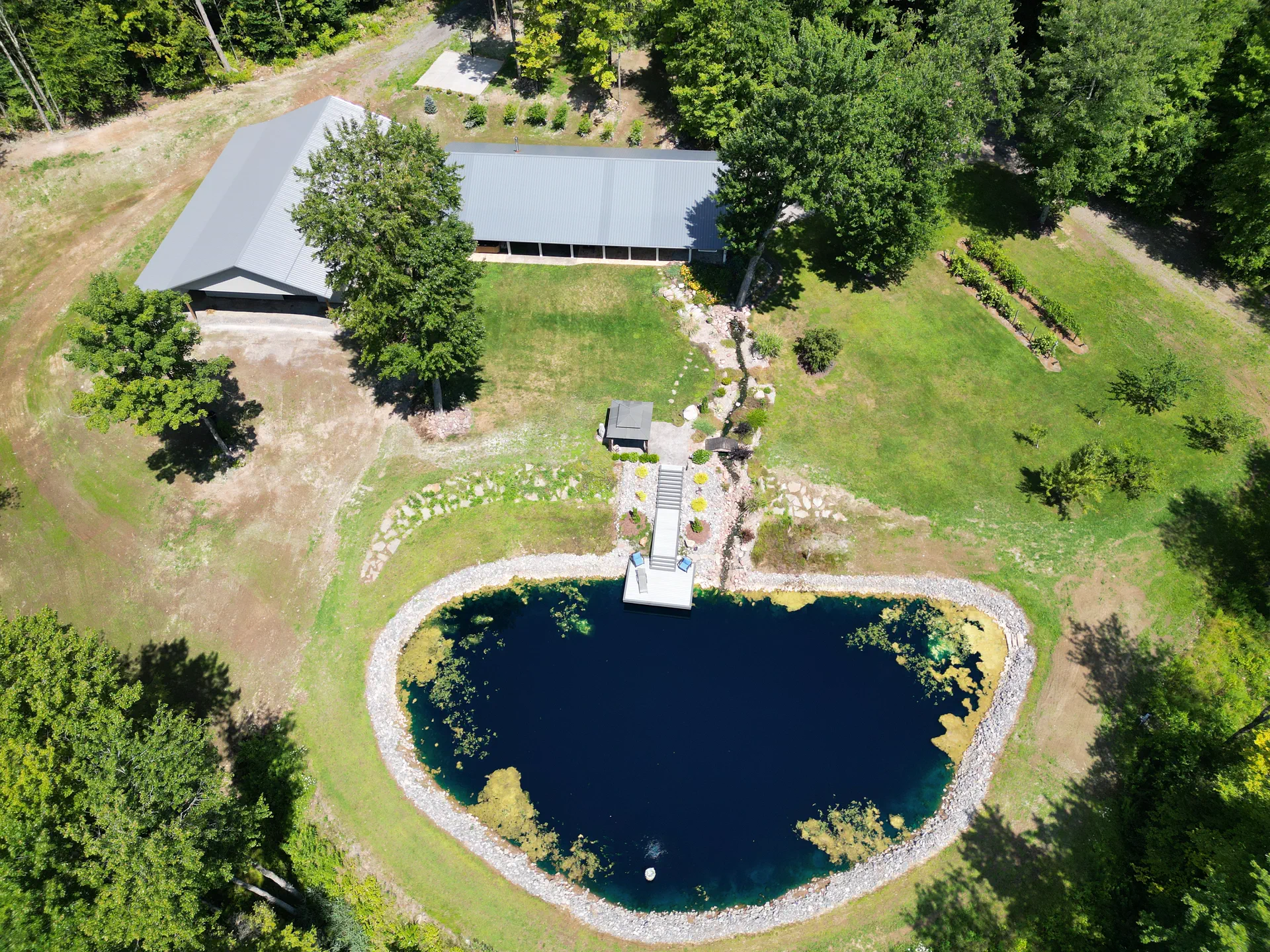
Aerial photos and video that show what ground-level listing photos can't: the lot, the layout, the setting and what's nearby.
For anyone marketing a property
- Real estate agents & brokers
- Homeowners selling their home
- Land & farm sellers
- Commercial property owners
- Vacation-rental hosts
- Developers & builders
Problems it solves
- Lot size and shape are hard to picture. Show the full property and how it sits on the land.
- Features get lost in ground photos. Highlight ponds, outbuildings, acreage, water access and long driveways.
- Remote buyers can't visit. Give them a sense of the neighborhood and surroundings.
- Listings look alike. Strong aerial images and video help yours stand out.
What you can request
Pick what suits the listing. The number of photos, the shots and the final list are agreed in your quote, so you know exactly what you'll receive.
Edited aerial photos
Photos from several heights and angles, corrected for color and exposure and sized for MLS, websites and print.
Files: JPG, in 4:3 or 16:9
Low-level & eye-level views
Exterior views of the home, entrance and outbuildings from lower heights to round out the set.
Files: JPG
4K video clips
Smooth orbits, reveals and flyovers for listing videos and social media.
Files: MP4
Property highlight graphics
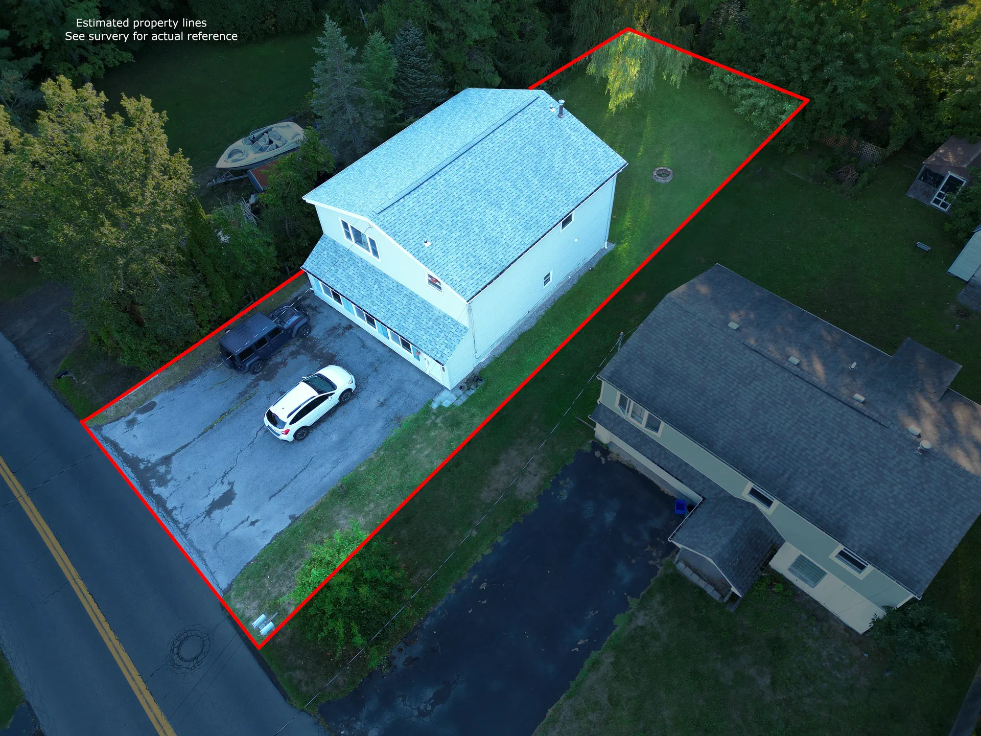
An approximate property-line overlay, with the surroundings darkened so the property stands out. Drawn from a survey you provide or a parcel reference you approve, and labeled approximate.
Files: JPG
Land overview map
For acreage and farms: the whole parcel in one detailed, to-scale image showing fields, woods, ponds and access.
Files: JPG or PDF, plus GeoTIFF
Original RAW files
Unedited originals from the main camera, for your own editing.
Files: DNG
About property-line graphics
Property-line overlays help buyers understand roughly where a lot begins and ends. They're drawn from a survey you supply or a parcel reference you approve, and every one is labeled approximate.
They're marketing illustrations. They don't locate or verify a legal boundary; in New York that requires a licensed land surveyor.
Good to know
- Exterior aerial and low-level views only. Pair this with your interior photographer.
- Sites near airports may need FAA authorization. I request it when the location requires it.
- Clear, calm days give the best results; flights are rescheduled if conditions aren't right.
Real estate questions
How many photos will I get?
It depends on the property and what you want to show. Your quote lists the shots and the number of edited photos before you book.
Can you add property lines?
Yes, as an approximate graphic drawn from a survey you provide or a parcel reference you approve. It's labeled approximate and isn't a survey.
Do you photograph interiors?
No. This service covers exterior aerial and low-level views. It pairs well with your regular listing photographer.
Can you photograph land with no buildings?
Yes. Land, farms and woodlots often benefit most from aerial views, and a land overview map shows the whole parcel in one image.
Listing a property soon?
Send the address and your listing date, and I'll reply with options.